Every climbing shop in the mountains sells the current guidebook, and rightly so. What we sell, a shelf away, is the previous one, and the one before that, going back decades. Customers occasionally ask why anyone would want them.
The short answer is that an old route guide stops being a set of instructions and becomes a document. It records what a range looked like, what was known about it, how climbers of that decade thought, and which approaches existed before the roads and closures changed.
Read that way, superseded guides are among the most informative regional books we handle. This article is about what they can tell you, and about the very clear limits on how they should be used.
What a Guidebook Actually Freezes in Place
A guidebook is a snapshot of collective knowledge at the moment of writing. It records which routes had been climbed, what they were called, how hard they were thought to be, and what the author considered worth including.
All four of those change. Routes get added, names get standardised or disputed, grades get revised as consensus shifts, and the editorial judgement of what deserves a page moves with fashion in the sport.
That instability is precisely what makes old editions useful. Comparing two guides thirty years apart shows you the history of an area’s development more clearly than any narrative account, because the change is visible line by line.
Approaches, Access, and Vanished Trails
The most dramatic changes in older guides are usually not on the routes but on the way in. Approaches described in a 1970s guide may cross land now closed, follow logging roads that have been reclaimed, or start from parking areas that no longer exist.
Sometimes the change runs the other way, and an old guide records a trail or a bridge that has since been forgotten by everyone except the people who used it.
Safety first: never plan a current trip from an old approach description. Closures, wildlife restrictions, seasonal access rules, and washouts make historical approach information unreliable and occasionally dangerous.
As history, though, this material is excellent. It maps how access to a range evolved, and it explains why certain classic routes fell out of favour while others became crowded.
Grades, Ethics, and the Language of a Decade
Grading systems drift. A route rated at a certain number in 1965 may carry a different number now, not because the rock changed but because the reference points did, and because protection and equipment improved.
The prose changes too, and it is often the most revealing part. Older guides carry assumptions about what is reasonable, what is sporting, and what counts as a proper ascent, stated with a confidence that a modern guide would not use.
Reading those passages is the fastest way to understand the ethics of a period: what was considered acceptable protection, how aid was regarded, and how much uncertainty climbers were expected to accept as normal.
Naming, Attribution, and Local Memory
Old guides preserve names. Some routes were renamed, some first ascents were later reattributed, and some features carried local names that never made it into the official record at all.
For anyone researching the history of an area, these details matter. A first-ascent credit in a 1958 guide, corrected in 1982, tells you something about how the record was assembled and who was doing the assembling.
- Original route names before standardisation
- First-ascent credits as recorded at the time
- Local names for features and approaches
- Descriptions of formations later renamed or reclassified
- Acknowledgements naming the local climbing community of the period
Photographs, Topos, and What the Mountains Looked Like
The photographs in older guides are frequently their most valuable content. Black and white images of faces and glaciers from fifty or sixty years ago document conditions that have changed substantially, particularly on ice and snow routes.
Glacial recession is the clearest example. A photograph of an approach glacier from the 1960s next to one taken this decade makes a point that no amount of description conveys, and researchers use exactly this kind of comparison.
Hand-drawn topos have a similar charm and a similar use. They show what the author thought the important features were, which is a kind of evidence about how a route was understood before it was over-described.
Who Actually Buys Them, and Why
The buyers for older guides are more varied than you might expect. Local climbers building a complete run of editions for an area they care about. Researchers and writers working on the history of a range. Guides and instructors interested in how their own profession developed.
Then there are the people who climbed from that edition originally and want the copy they used at twenty, complete with its dated grades and its particular photographs, because it is tied to a specific period of their own life.
That last group tends to move fastest. A guide with sentimental as well as historical value does not sit on the shelf long once word gets out that we have one.
Condition Expectations for Working Books
Guidebooks were carried in packs, used in rain, and shoved into jacket pockets. A pristine copy is unusual and, in some ways, less interesting than a well-used one.
We describe the wear honestly, and we pay attention to the annotations, because a previous owner’s ticks, dates, and notes beside routes are a record of one climber’s seasons. Some buyers want a clean copy; others specifically want the annotated one.
What we check before listing
- Whether all topo pages and fold-out plates are present
- Water damage and cockling from field use
- Annotation, and whether it is pencil or ink
- Detached sections, which are common in heavily used guides
- Edition and printing, since guides are frequently revised
Comparing Editions Side by Side
The most productive way to use old guides is comparatively. Put two editions of the same area guide, twenty or thirty years apart, beside each other and read the same route in both.
What changes is instructive: the grade, the length of the description, the amount of protection assumed, the named first ascensionists, the approach, and the tone. What stays identical is usually the rock itself and very little else.
- Grade changes and what they imply about equipment and consensus
- Routes added, and how quickly an area filled in
- Routes dropped, often because access closed
- Approach changes reflecting roads, trails, and closures
- Photographs of the same feature decades apart
Guides as Records of a Climbing Community
Guidebooks are written by people embedded in a local scene, and they preserve that scene incidentally. Acknowledgements name who was active. Route credits name who was climbing hard that decade. Introductions record arguments about bolting, access, and style that were live at the time.
For a regional history of climbing, this is primary source material of a kind that no retrospective account can replace, because it was written without the benefit of knowing how things turned out.
It also explains local conventions that otherwise seem arbitrary: why a certain crag is approached from one side, why a particular grade feels stiff, why one area is bolted and the next is not.
Where to Get Current Information Instead
Because this article is largely an argument for reading old guides, it is worth being explicit about where current information should come from.
For an actual trip: use the latest edition of the area guide, current route and conditions reports, park and land manager notices for closures and seasonal restrictions, and local guiding services. Historical guides are for context, not for planning.
This is not a formality. Approach closures for wildlife, seasonal restrictions, changed parking, and altered glacier travel are exactly the categories where an old guide is most confidently wrong, and confidence is the dangerous part.
Building a Run of One Area’s Guides
The most rewarding way to collect guidebooks is to pick a single area and assemble every edition of its guide, from the earliest to the current one.
A complete run turns a shelf into a continuous record. You can trace the development of an area decade by decade, watch the grade consensus shift, follow the approach changes, and see which routes were forgotten and which became classics.
- Every edition of one area guide, in sequence
- Interim supplements and update pamphlets, often scarcer than the guides
- Club journals covering the same area and period
- Any photocopied or locally circulated topos that preceded formal publication
- Later histories of the area for comparison
The difficulty is the middle editions. First editions get kept as curiosities and current ones are in print, but the guide from twenty years ago was used hard, superseded, and thrown out. Those are the copies to buy when they appear rather than to think about, because they are genuinely the scarcest part of the run.
Storing and Handling Working Guides
Guidebooks were built light and carried hard, which makes them fragile once they leave active use. Soft covers curl, fold-out topos tear along their creases, and blocks detach where a spine has been repeatedly bent back.
Store them upright but not tightly packed, keep fold-outs folded rather than flattened under weight, and resist the urge to tape a loose section. Tape stains through thin guidebook paper faster than almost any other stock.
For a run of editions kept as a reference set, a shallow box or a single dedicated shelf works better than filing them among general climbing literature, if only because it makes the comparison between editions easy enough that you will actually do it.
Using the Old and the New Together
The sensible position is not old guide versus new guide but both, used for different purposes. The current guide tells you what the route is and where it goes today. The old guide tells you how it came to be there.
For actual climbing, use current information: recent route reports, local guiding services, park access notices, and the latest edition. Nothing on our history shelf substitutes for any of that.
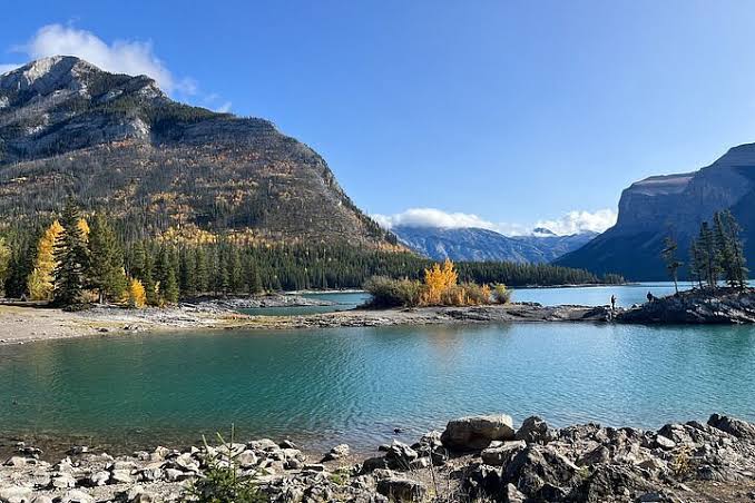
For understanding the place, the old editions are irreplaceable. They preserve a version of the Rockies that existed before the highway improvements, the closures, the retreat of the ice, and the enormous growth in visitor numbers. A climber who reads both is climbing in a landscape with depth to it, and that is worth the shelf space even if the book never leaves the house again.